

You are using an out of date browser. It may not display this or other websites correctly.
You should upgrade or use an alternative browser.
You should upgrade or use an alternative browser.
Compass and Map, just fyi in case you forgot your 'device'...
- Thread starter wakosama
- Start date
The #1 community for Gun Owners in Texas
Member Benefits:
Fewer Ads! Discuss all aspects of firearm ownership Discuss anti-gun legislation Buy, sell, and trade in the classified section Chat with Local gun shops, ranges, trainers & other businesses Discover free outdoor shooting areas View up to date on firearm-related events Share photos & video with other members ...and so much more!
Member Benefits:

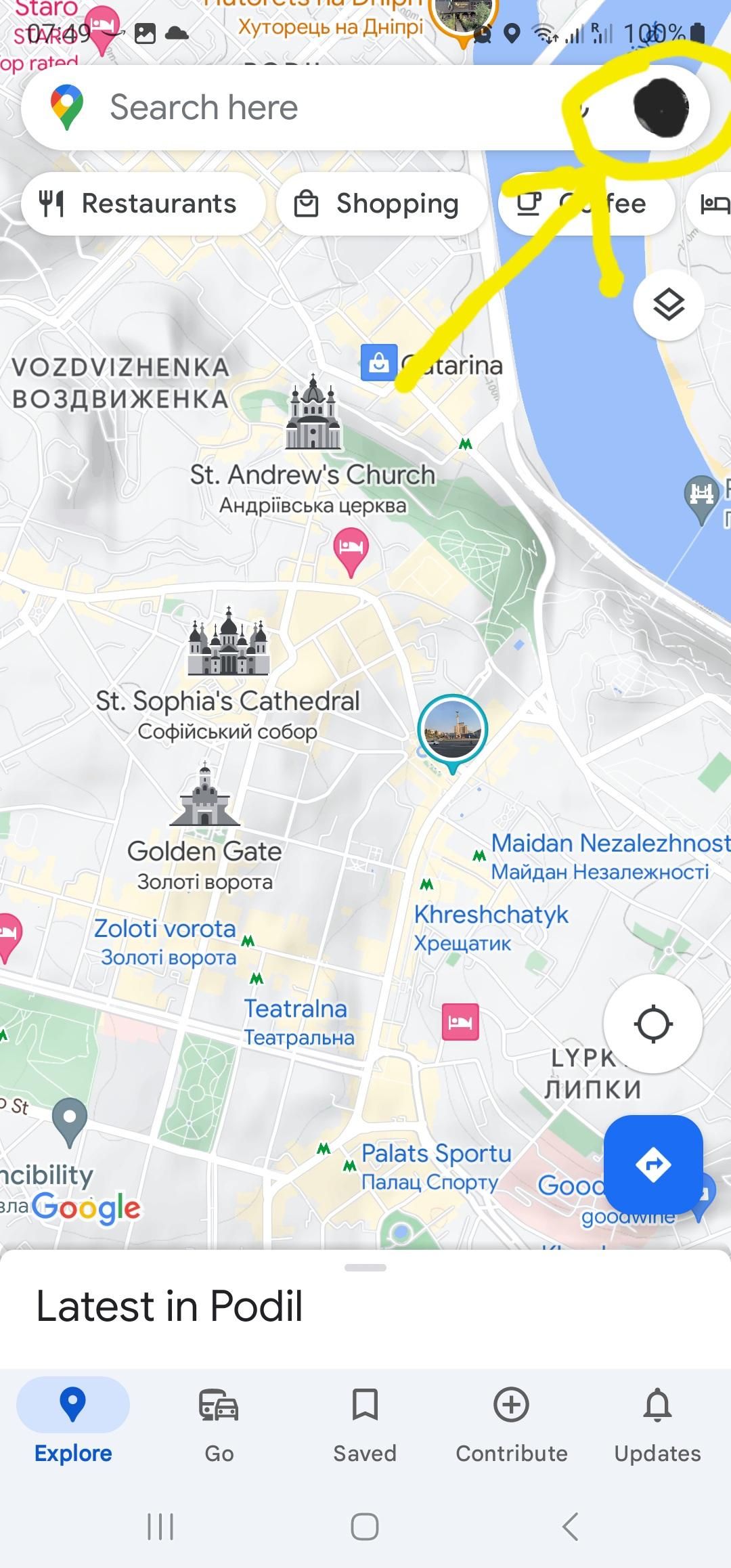
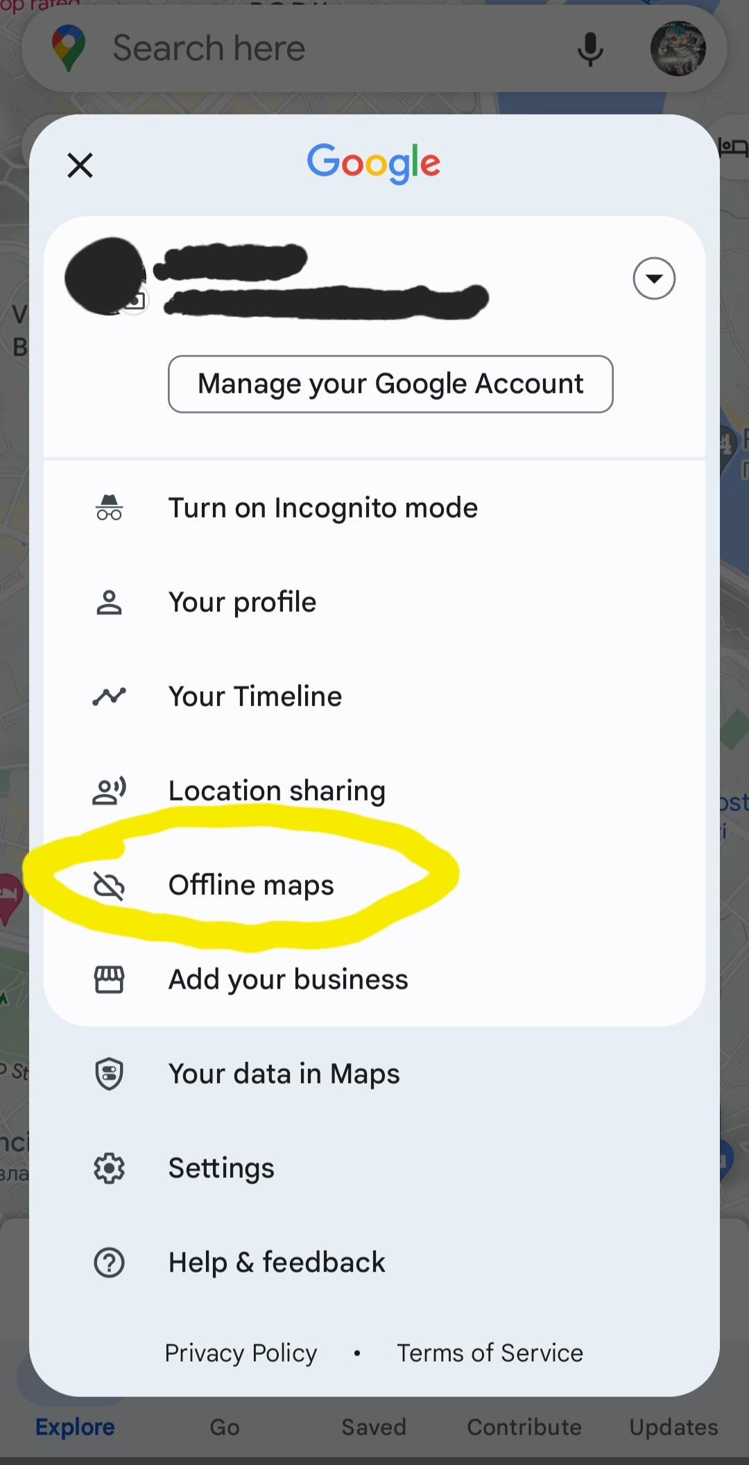
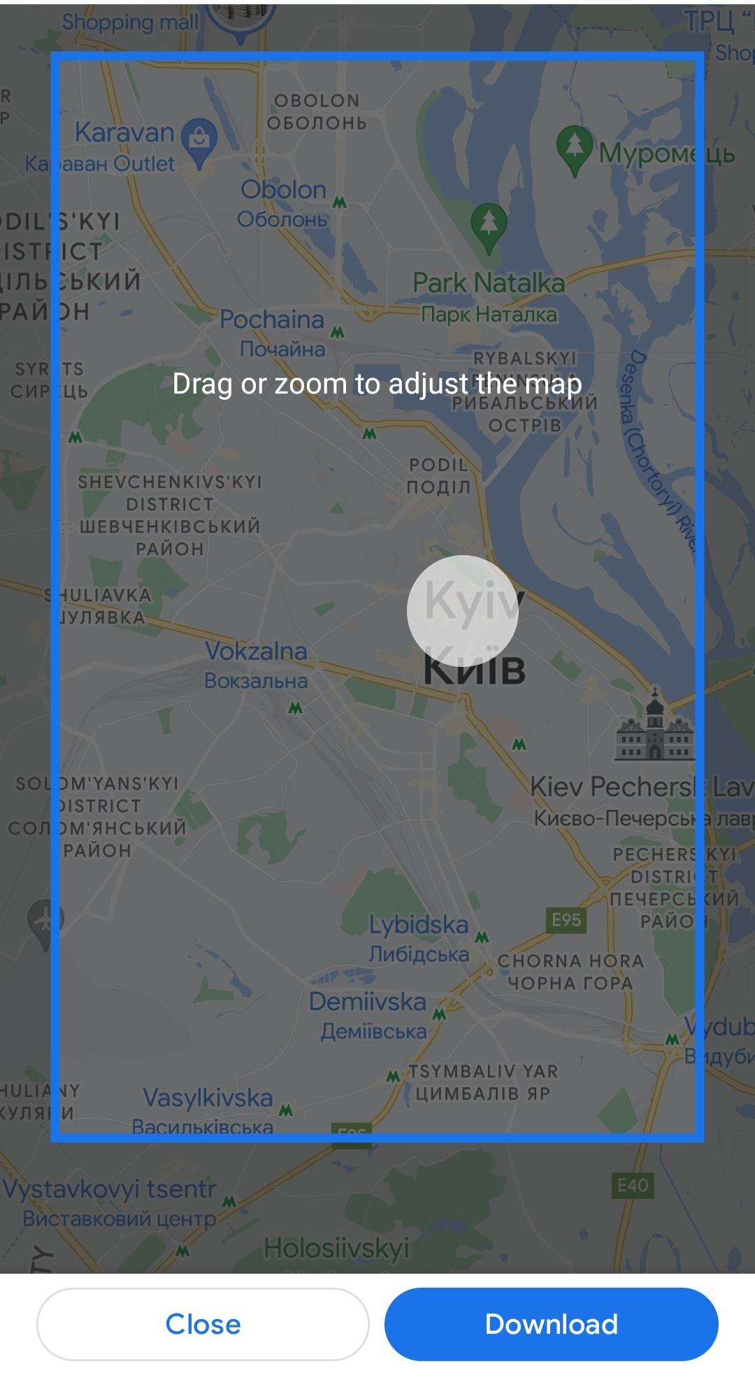
I didn’t know google had that. That’s a good feature as long as people use it.Even google maps allows for a download of an off-line map. Its not a huge map area iirc.
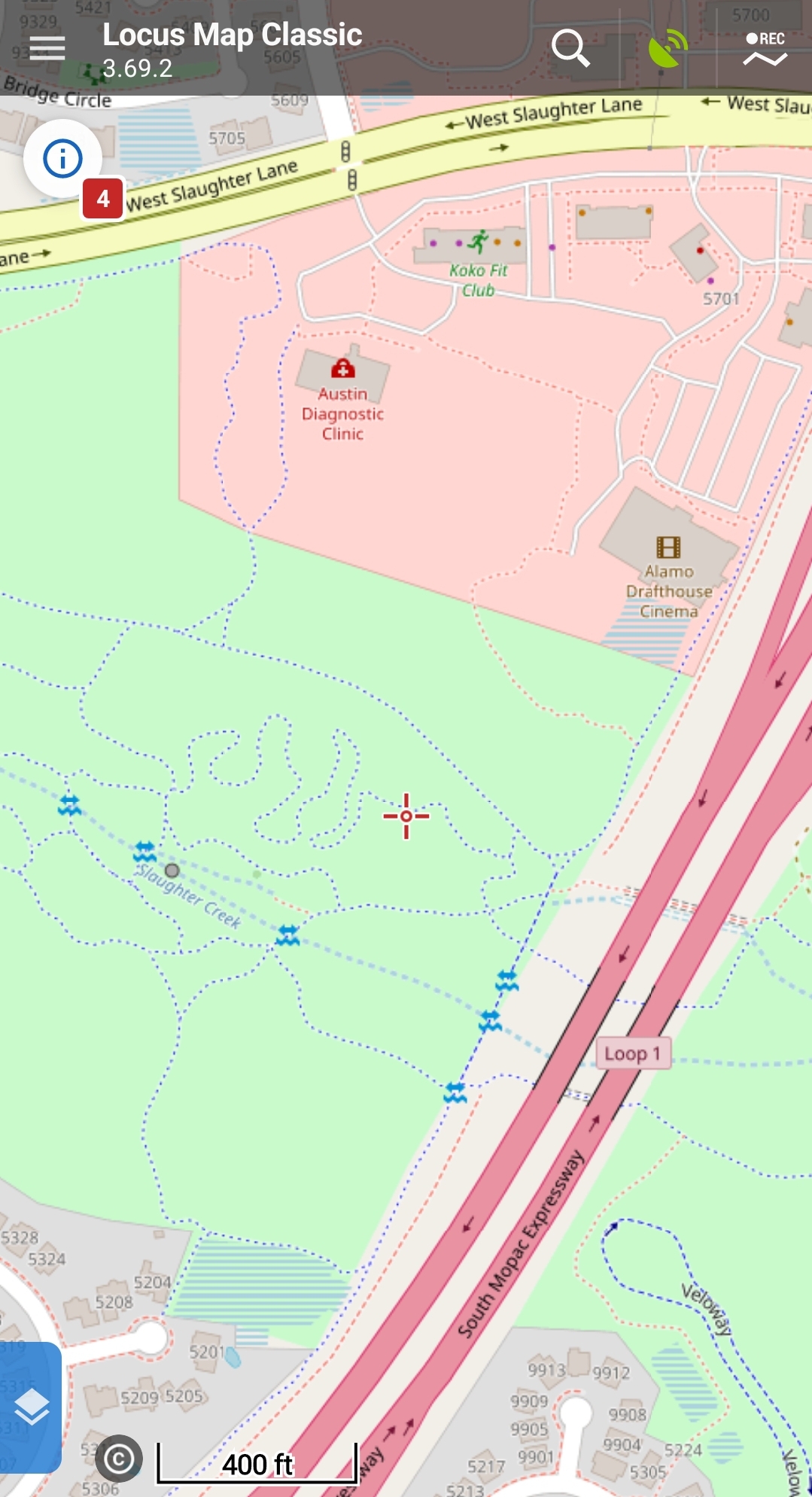
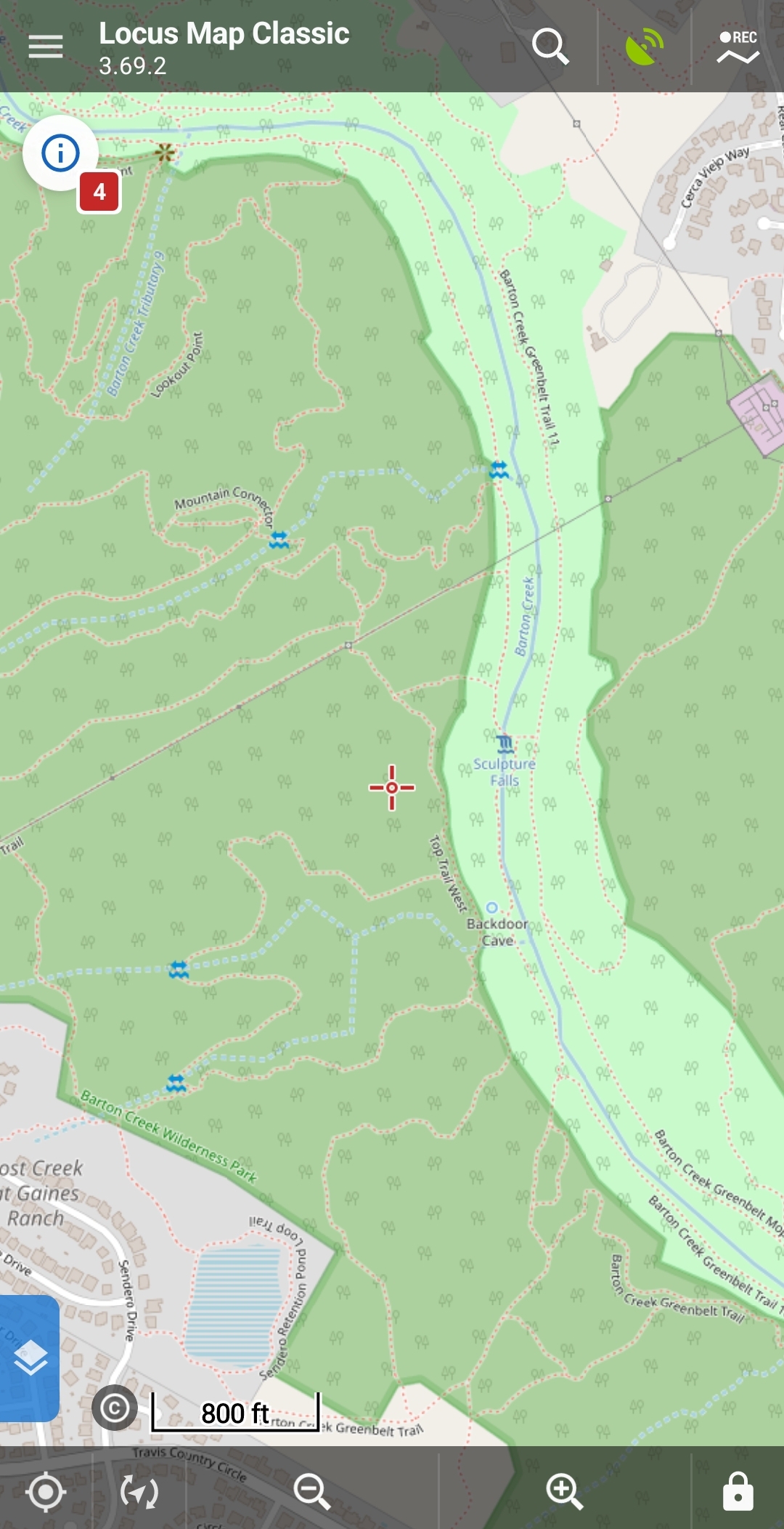
I paid for Locus Pro/Classic. Downloadable by state for a few cents each, with lots of trails and features not on googlemaps and some powerful navagation features. Well worth the $10 for a fully off-line map that is highly detailed and includes accurate elevation data with multiple downloadable maps from lots of sources.
Sent from my SM-S918B using Tapatalk
<>
I’ve noted that many of today’s “Young” have zero idea of directions. When I tell them: “You know the time of year, time of day, & Sun position; you have your basic orientation: they just give a blank stare. . . . . . .
<>
I’ve noted that many of today’s “Young” have zero idea of directions. When I tell them: “You know the time of year, time of day, & Sun position; you have your basic orientation: they just give a blank stare. . . . . . .
<>
Last edited:
I use it often. I always look at the area where I'm going first anyways. That way if the phone goes down I can pick a general heading and eventually run into something I recognize.I didn’t know google had that. That’s a good feature as long as people use it.
I used to do orienteering for fun. Of course that was 20+ years ago, but I could muddle through if I needed to.
It is definitely a lost art on some people now a days. I grew up orienteering in boy scouts and now as a forester that I try to not use technology except for a compass most of the time. When I did research in Louisiana we used a combination of compass and GPS and still basically use that over my phone unless I am in a city. Give me aerial photos any day along with quads.
cycleguy2300
TGT Addict
Just takes a few clicks.I didn’t know google had that. That’s a good feature as long as people use it.
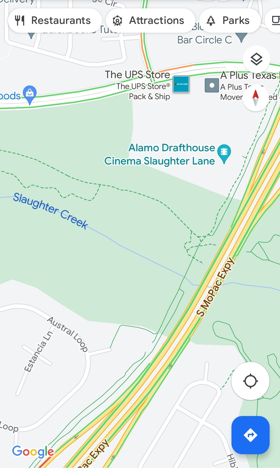
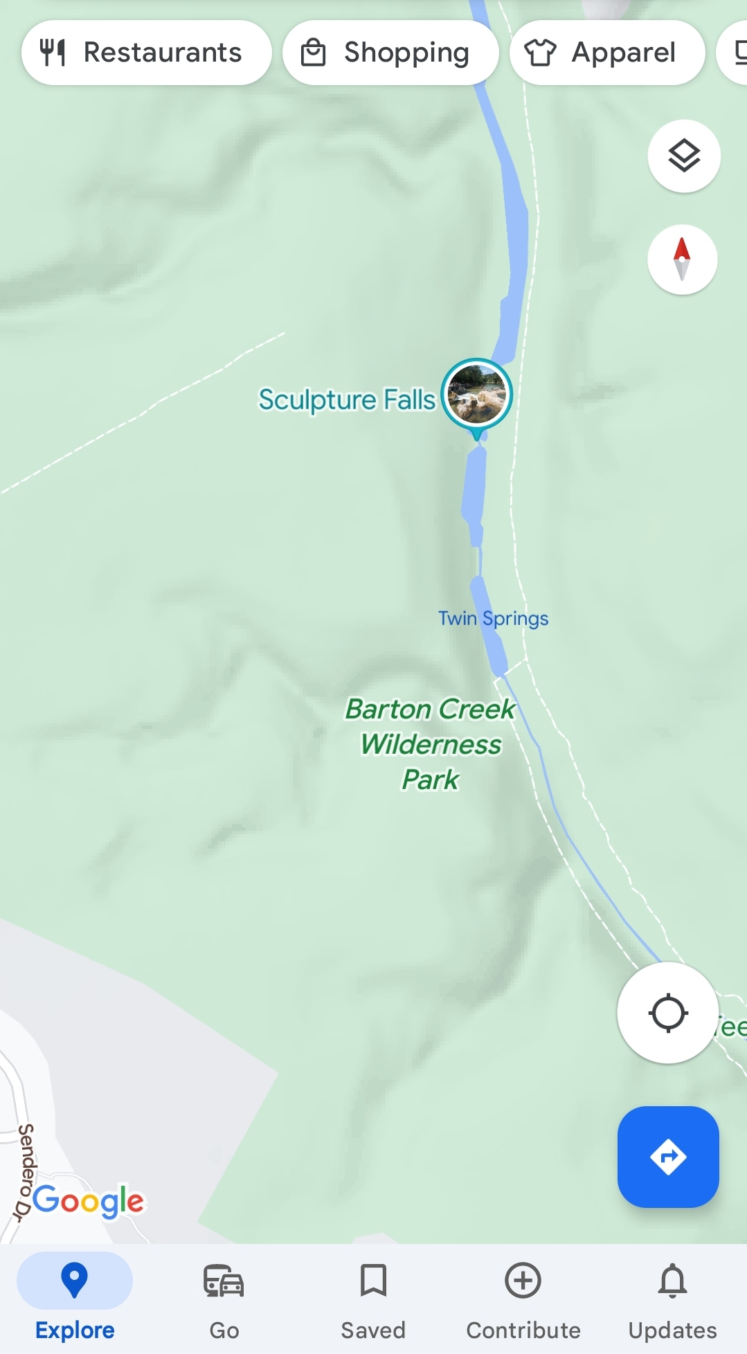
I like Locus much better as an offline map, because it was fully designed to be used independently from cell or wifi and you have different maps which highlight/showcase different things. But being able to save a remote chunk of map on Google Maps is really handy

Sent from my SM-S918B using Tapatalk
Plenty of people don’t realize that the map data on their phone relies on cell service until they are in the middle of nowhere and have neither. The glowing blue dot does no good when it’s in the middle of a blank screen.
This is true but there are plenty of apps that allow download of map data for offline use. Even if having paper maps is your normal it would be wise to have digital maps where the phone GPS works without cell towers and the map data is aligned. This just makes sense to use as an available tool.
I use a topo download app, Navmii offline road maps (openstreetmap) and hunt /property ownership layers from OnXHunt, with large areas saved for offline reference. Knowing where you are headed is good, but knowing whose land youre walking across doesnt hurt.
Only three major risks I have identified with these tools for offline apps as a backup. Since it is backup to paper, an EMP is not one of those risks.
1) GPS could become untrustworthy in a conflict of state actors, and could lead you astray, any trust of gps is gone the moment state actors are involved in regional conflict
2) apps that update and purge your local downloaded resources without you knowing, which does happen.
3) failure to maintain priority on paper map skills and dependence on the backup solution as primary
Yeah, another poster mentioned apps that could store different amounts of map data. It’s good that some apps are moving this way. How many people are using anything other than their apple maps(for iPhone users) though? unless they’ve made a recent change, what you see when you lose service is what you’ve got. I always keep a handheld garmin GPS in my truck that I can use, and if I’m planning on being in the middle of nowhere, would also want a map and compass.This is true but there are plenty of apps that allow download of map data for offline use. Even if having paper maps is your normal it would be wise to have digital maps where the phone GPS works without cell towers and the map data is aligned. This just makes sense to use as an available tool.
I use a topo download app, Navmii offline road maps (openstreetmap) and hunt /property ownership layers from OnXHunt, with large areas saved for offline reference. Knowing where you are headed is good, but knowing whose land youre walking across doesnt hurt.
Only three major risks I have identified with these tools for offline apps as a backup. Since it is backup to paper, an EMP is not one of those risks.
1) GPS could become untrustworthy in a conflict of state actors, and could lead you astray, any trust of gps is gone the moment state actors are involved in regional conflict
2) apps that update and purge your local downloaded resources without you knowing, which does happen.
3) failure to maintain priority on paper map skills and dependence on the backup solution as primary
I still have paper maps from back east and even from when I first moved out west.
I used paper maps and a big atlas all of my life. Compass too.
My husband has all kinds of PAPER maps for Montana from a to z. Plus for ID and WY too. LESS of them though.
Both of us are old and we were taught to READ and use maps.
Plus use a compass.
I thought that most people who hiked or traveled a lot would still know HOW to read a map and use it.
Several years ago, some people who were helping out a charity and they came to my fairly new built house. They were using some type of a THING map in their vehicle or on a cellular telephone and I could see them down the street.
I told the director when I first made the call to the charity HOW to get here, that I was on a DEAD END street from X AND X STREETS with a HUGE no build zone behind me - there are ONLY 4 houses back here TOTAL, my house has a NUMBER ON IT, I even told them the description of my house, and I left the PORCH LIGHT and garage door lights on even in the daylight!
I even had some of the STUFF to be donated ALREADY sitting on the front porch. Put out an hour ahead of PICKUP time and I would add more stuff to it,
I have NO clue how they missed it as I saw them drive away. I immediately called the charity and explained it all.
They did come back ASAP TO MY HOUSE after their BOSS called them after I called her back!
They were younger helpers in their 20's and ALL they had to do was LOOK OUTSIDE of their windows instead of their telephone or vehicle fancy/dancy MAP and see ME standing on the front porch WAVING TO THEM and yelling towards their vehicle.
I swear that these types of people especially younger ones and even some OLD PEOPLE like me would FALL OFF OF A CLIFF since their noses and faces are ALWAYS FACING DOWN towards some SCREEN.
They have NO SITUATIONAL AWARENESS for their own safety or crime issues and a total LACK of observing even the most simple things when they are OUTSIDE in the city, small town or even in the BOONIES!
God forbid, they should venture off into the wilderness or woods.
I bet that they could not be on a sail boat or power boat and see the channel markers on a LAKE, on a river or by the ocean going in or out of a small or large body of water.
They might not even SEE an old fashioned lighthouse with the BEAM shining in their eyes too!
We do NOT have a smart or dumb telephone aka cellular telephone. ONLY a landline - house telephone.
Old Lady Cate
ADDED more.
Last edited:
<>I use it often. I always look at the area where I'm going first anyways. That way if the phone goes down I can pick a general heading and eventually run into something I recognize.
I used to do orienteering for fun. Of course that was 20+ years ago, but I could muddle through if I needed to.
’’I always look at the area where I'm going first anyways.’’
And, when entering a strange or new place, turn around once in a while to see what the way-back-out looks like, too.
Basic outdoorsmanship. easily applied to urban environments.
<>
<>I still have paper maps from back east and even from when I first moved out west.
I used paper maps and a big atlas all of my life. Compass too.
My husband has all kinds of PAPER maps for Montana from a to z. Plus for ID and WY too. LESS of them though.
Both of us are old and we were taught to READ and use maps.
Plus use a compass.
I thought that most people who hiked or traveled a lot would still know HOW to read a map and use it.
Several years ago, some people who were helping out a charity and they came to my fairly new built house. They were using some type of a THING map in their vehicle or on a cellular telephone and I could see them down the street.
I told the director when I first made the call to the charity HOW to get here, that I was on a DEAD END street from X AND X STREETS with a HUGE no build zone behind me - there are ONLY 4 houses back here TOTAL, my house has a NUMBER ON IT, I even told them the description of my house, and I left the PORCH LIGHT and garage door lights on even in the daylight!
I even had some of the STUFF to be donated ALREADY sitting on the front porch. Put out an hour ahead of PICKUP time and I would add more stuff to it,
I have NO clue how they missed it as I saw them drive away. I immediately called the charity and explained it all.
They did come back ASAP TO MY HOUSE after their BOSS called them after I called her back!
They were younger helpers in their 20's and ALL they had to do was LOOK OUTSIDE of their windows instead of their telephone or vehicle fancy/dancy MAP and see ME standing on the front porch WAVING TO THEM and yelling towards their vehicle.
I swear that these types of people especially younger ones and even some OLD PEOPLE like me would FALL OFF OF A CLIFF since their noses and faces are ALWAYS FACING DOWN towards some SCREEN.
They have NO SITUATIONAL AWARENESS for their own safety or crime issues and a total LACK of observing even the most simple things when they are OUTSIDE in the city, small town or even in the BOONIES!
God forbid, they should venture off into the wilderness or woods.
I bet that they could not be on a sail boat or power boat and see the channel markers on a LAKE, on a river or by the ocean going in or out of a small or large body of water.
They might not even SEE an old fashioned lighthouse with the BEAM shining in their eyes too!
We do NOT have a smart or dumb telephone aka cellular telephone. ONLY a landline - house telephone.
Old Lady Cate
ADDED more.
Sadly, so true. . . . . .
Yet, they know so much more than we know.
Ignorance & arrogance make for a really bad combination !
<>
The night before heading out to wade fish in the morning - I'd take a pair of parallel rules to the compass rose on my fishing charts and write down the various azimuths to where I'd go.
I never trusted any type of gps as they're so often wrong...
I never trusted any type of gps as they're so often wrong...

<>The night before heading out to wade fish in the morning - I'd take a pair of parallel rules to the compass rose on my fishing charts and write down the various azimuths to where I'd go.
I never trusted any type of gps as they're so often wrong...
Few today would recognize ‘’parallel rules’’, or have any idea what they are for.
<>

cycleguy2300
TGT Addict
When was the last time a GPS was wrong by more than a few feet after a few seconds of calculation. The FAA wouldn't allow GPS to be used for aircraft autopilots if they didn't work dang good. ATAK, Locus and even Google maps can show me which room in my house I am in...The night before heading out to wade fish in the morning - I'd take a pair of parallel rules to the compass rose on my fishing charts and write down the various azimuths to where I'd go.
I never trusted any type of gps as they're so often wrong...
While knowing how to make do without is good, and useful, you gain nothing by being a Ludite and in-fact lose substantial time that could be directed at other tasks. Why not navigate with stars and forgo the often wrong paper maps and the compass that can deviate depending on location??
Sent from my SM-S918B using Tapatalk
<>When was the last time a GPS was wrong by more than a few feet after a few seconds of calculation. The FAA wouldn't allow GPS to be used for aircraft autopilots if they didn't work dang good. ATAK, Locus and even Google maps can show me which room in my house I am in...
While knowing how to make do without is good, and useful, you gain nothing by being a Ludite and in-fact lose substantial time that could be directed at other tasks. Why not navigate with stars and forgo the often wrong paper maps and the compass that can deviate depending on location??
Sent from my SM-S918B using Tapatalk
Indeed, current GPS is so good that the entire World depends on it.
And, our government can turn it off, or turn parts of it off, at any time.
Hmmmmmm ?
<>